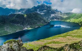
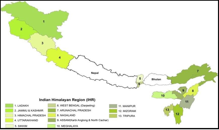
Background: Indian Himalayan region (IHR) stretches over 2,500 km from Jammu and Kashmir in the west to Arunachal Pradesh in the east, covering partially/fully 13 States/UTs of India (Jammu & Kashmir, Ladakh, Uttarakhand, Himachal Pradesh, Arunachal Pradesh, Manipur, Meghalaya, Mizoram, Nagaland, Sikkim, Tripura, Dima Hasao and Karbi Anglong Districts of Assam, and Darjeeling & Kalimpong districts of west Bengal), with total geographical area of 53.7 M ha. IHR is known for alpine meadows, river valleys, lake basins, cold deserts, inter mountain valleys, deep gorges, snow fields, glaciers and alluvial plains. Broadly, it has been categorized into Higher Himalaya, Lesser Himalaya and Sub Himalaya and inhabited by 57 million people of which 75% is rural population.
The region being a repository of rich biodiversity is recognized as a ‘Climate Marker’. Different cultural backgrounds of the inhabitants coupled with variable food habits and climatic situations resulted in cultivation of diverse and mixed crops of cereals, pseudocereals, pulses, oilseeds, vegetables, fruits, spices and flowers. Agroforestry, animal husbandry and fisheries are the integral parts of their cropping/farming systems. The system is characterized by large variation in cropping intensity (range 100-189% with an average of 135%) with mono-cropping in Eastern Himalayas.
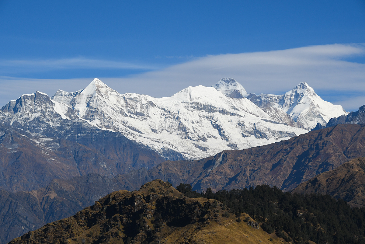
The higher ranges remaining perpetually snowbound, overlooked by more than 13 peaks surpassing 7000 m in elevation. It plays a vital strategic role in safeguarding the entire northern boundary of the nation. Apart from the national security standpoint, the Himalayan region is also important for its high forest cover. More than 65% of its geographical area is under forests, representing one-third of the total forest cover and nearly half (46%) of the very good forest cover of the country.
Total agriculture area in IHR is accounted for 7.30 M ha with net sown area of merely 4.21 M ha. While settled cultivation prevails in North West Himalayas, shifting followed by settled cultivation is found in most Eastern Himalayan states except Sikkim. Agriculture in IHR is, by and large, Complex, Diverse and Risk prone (CDR) type of agriculture, which also has a threat due to migration of rural youth in search of employment to the plains, land fragmentation & degradation, natural calamities, shift from agriculture to non- agriculture occupation, limited access to quality inputs and extension reforms. Of the 806 districts of India, 133(16.5%) are confined in IHR. Likewise, of the 640930 villages at the national level, 66679 (10.4%) belongs to IHR. The details of the same is depicted below: