Approach
-
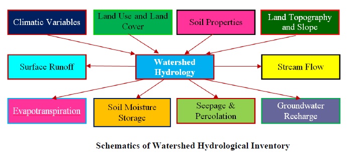
The hydrological assessment will be based on watershed characterization and hydrological modeling for finding the gap between existing and potential status of the selected micro-watersheds. The data related to LRI will be acquired from LRI team of REWARD for modeling. Other inputs data like weather, groundwater, crop etc. are to be collected from various open and authentic sources. Watershed characterization will be taken up with the help of remote sensing and GIS technology. Assessment of surface and groundwater parameters is proposed with the help of available hydrological models and GIS technology. The possible outcomes of the approach would be quantification of available water resources for their sustainable management at MWS scale. The critical parameters involved with hydrological assessment are portrayed in Figure. Necessary refinement of the model will be made on the basis of ground truthing, public opinion and
17 as per the site requirements. The model calibration and validation will be carried out with the observed data. DSS development will be based on satisfactory model simulation.

भारतीय कृषि अनुसंधान परिषद
- भारतीय मृदा एवं जल संरक्षण संस्थान देहरादून.


